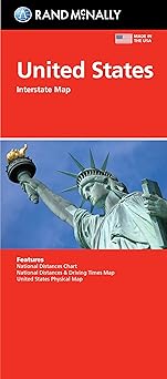
Rand McNally United States Interstate Fold Map
by Rand McNally
Published
March 1, 2024
Pages
1 pages
Language
English
Publisher
RAND MCNALLY & CO.
Available Formats & Prices
View on AmazonAudio CD
$9.99
About This Book
Rand McNally's United States folded map features clear, easy-to-read cartography showing all Interstate and U.S. highways, along with clearly indicated cities, points of interest, airports, boundaries, and more. Rand McNally folded maps have been the trusted standard for years, offering unbeatable accuracy and reliability at a great price.
- Interstate and U.S. highways. - Indications of cities, points of interest, airports, boundaries, and more.
- Mileage chart. - Mileage & driving times map. - National facts and symbols.
- Toll roads chart. - United States physical map. - Visitor information.
Product Details: Measures 4.125" x 9" and folds out to 25.5" x 36.75".
Introduction
The Rand McNally United States Interstate Fold Map is a quintessential tool for travelers seeking reliable navigation across the expansive highways of America. Known for their detailed cartography and updated routes, Rand McNally presents this map as an essential accessory for those embarking on a road trip or simply traversing the country. With a legacy of precision and clarity, this map ensures that travelers can journey with confidence, whether for leisure or business, providing guidance through the complex network of national highways.
Key Takeaways
Accurate updates ensure users have the latest highway information for seamless travel. Compact foldable design makes it convenient for travel and storage. Exceptionally detailed with clear markings of major cities and route numbers.
Detailed Description
The Rand McNally United States Interstate Fold Map offers an invaluable resource for navigating America's vast highway system. Travelers benefit from the comprehensive detail and precision synonymous with Rand McNally making this map a trusted companion on any journey. The map's design emphasizes user convenience boasting a foldable and compact format that simplifies storage and accessibility while traveling.
Users can easily access critical route information at a glance enhancing travel efficiency. Clearly marked highways and significant points of interest from major urban centers to notable geographical features ensure that this map serves both practical navigation needs and as a reference for curious explorers. Updates have been meticulously integrated to reflect the latest road developments and interstate changes cementing its place as a modern guide for America's ever-evolving transportation infrastructure.
With its legacy rooted in accuracy and usability this map is integral for anyone venturing onto the open road prioritizing both reliability and ease of use in a traveler's journey.
Standout Features
One of the unique aspects of the Rand McNally United States Interstate Fold Map is its commitment to updating road information to guarantee travelers have the most current data Renowned for its precise cartography the map excels in showcasing intricate details from minor roadways to major transportation routes ensuring comprehensive coverage and utility for users The map's clever design allows it to easily fold into a convenient portable size making it ideal for frequent travelers who value efficiency without compromising on the depth of information.
Book Details
0528027786
978-0528027789
4 x 0.25 x 9 inches
2.4 ounces
Specifications
Rating
Based on 3294 ratings
Customer Reviews
Across country view of US roads.
Really like seeing whole country in one view.
Perfect!
Exactly what we needed! Not sold in stores
Full US Travel Map
Exactly what I was looking for. Current map showing the full United States on one side of the map. Planning a cross country trip. We needed to see the whole USA map to plot attractions we wanted to see so we could plan our route accordingly. Great detail and easy to see state borders. Definitely would recommend.
Map
Map is fine, rather expensive if you ask me. They used to be 1.99
Great map
Used it to move cross country from the Oregon Coast to Florida. Used my highlighter pen to mark haw far and what city we stayed in along the way. We used GPS as well but this was fun.
Geography Is Fun!
With all the navigation apps these days, people seem to have lost the ability to find their way without a synthesized voice telling them when to turn, which lane to use and how long before the next twist of direction. With AT&T’s very frequent outages, I decided to get some “old school” backup in each of our vehicles. All technology fails at some point, but paper maps are there when you need them. And some day you will need them. In the meantime, they can give you something your screens don’t: a perspective as to where places are in relation to one another. All pilots have paper maps and digital navigation systems. Makes sense for the rest of us, too.
👍
Used it to plan our road trip. Easy to read
Great map
Great map. Good to have for planning and in the car