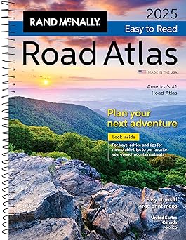
Rand McNally Midsize Easy to Read Road Atlas 2025
by Rand McNally
Published
April 8, 2024
Pages
160 pages
Language
English
Publisher
RAND MCNALLY & CO.
Available Formats & Prices
View on AmazonAudio CD
$16.90
About This Book
This updated 2025 midsize easy-to-read edition features large print maps of every U.S. state and Candian province, plus an overview map of Mexico, in a convenient travel size that fits in a glove box. Included are detailed inset maps of more than 50 North American cities, plus a Mileage and Driving Times Map showing distance and approximate driving times between hundreds of cities.
Spiral binding allows the books to lay open easily. Additional Features: - Rand McNally presents our editor's favorite year-round mountain retreats, with travel advice and tips from places to stay, family activities, and where to eat. - Tell Rand!
As much as we work to keep our atlases up to date, conditions change quickly and new construction projects begin frequently. If you know of something we haven't captured in our atlas, let us know at [email protected]. - Tourism websites and phone numbers for every U.S.
state and Canadian province on map pages. - Road construction and conditions contact information for every U.S. state and Canadian province.
- City index conveniently located on map pages. - Made in the USA. Product Details: Dimensions: 8" x 10.8125".
Spiral bound.
Introduction
The Rand McNally Midsize Easy to Read Road Atlas 2025 is meticulously crafted to enhance every traveler's experience, whether journeying through bustling cities or quaint countryside roads. This atlas combines user-friendly design with comprehensive data, ensuring that both casual explorers and seasoned adventurers find their way with ease and confidence. Its convenient size and updated maps make it an indispensable tool for anyone eager to explore the diverse landscapes that lie across the United States.
Key Takeaways
Embrace the adventure with updated maps covering the entire United States in easily digestible layouts. Discover new destinations and the best routes with clear labeling vibrant colors and useful travel tips. Highly accessible for visual ease offering large print maps ensuring every traveler can navigate confidently.
Detailed Description
The Rand McNally Midsize Easy to Read Road Atlas 2025 is a trusty guide for drivers seeking clarity and precision in their journeys. Each map is designed with vibrant colors and large print to accommodate drivers seeking effortless navigation. Comprehensive coverage includes the latest road updates making it ideal for planning both short road trips and extensive cross-country adventures.
Alongside its reliable maps it offers valuable travel information and insights. Readers will find mileage charts city indexes and driving laws all tailored to support efficient travel planning. These features are designed to enhance the traveling experience by providing not only paths but also insights into the roads.
As travel trends continue to evolve this atlas adapts with precision continuing to meet the needs of modern and curious travelers.
Standout Features
The Rand McNally atlas showcases expertly crafted maps that prioritize readability and ease making travel remarkably efficient for users Its midsize format is ideal for easy handling and storage in vehicles ensuring it's always within reach The atlas stands apart with its ongoing commitment to quality and innovation Readers will appreciate its user-friendly design which simplifies navigation and enhances the overall travel experience regardless of destination What truly sets this atlas apart is its unique combination of detailed cartography and vibrant design elements which together make deciphering each map a pleasure aiding in a truly seamless travel adventure.
Book Details
0528027573
978-0528027574
8.25 x 0.25 x 11 inches
12 ounces
Specifications
Rating
Based on 774 ratings
Customer Reviews
SOMETIME ITS GOOD TO HAVE AN ACTUAL MAP
I know we all use GPS - but there are times when we travel that we want to see what is around us and some idea of direction. This map is GREAT, easy to read and it is up to date.
Not real detailed
Works well
Small and easier to handle, but...
Great map. The print is too small. It is missing somethings the bigger map has. Love the spiral bound
Visual and compact
I know we all have some type of GPS, however, it was really helpful to have something else to look at and find alternative routes on our roadtrip. We navigated from MN to CA taking the scenic routes through each state. I liked using sticky notes on the pages to plan our trip and it helped us remember our options for fun stops and remember places we had been. It’s compact and useful to have in the glovebox!
Good map
We purchased this for a trip. I wish the maps were a little bigger but it stores and is easier to use in a car than the older large maps.
Great Atlas until you are lost in the mountains in West Virginia!!!
This is a great atlas for the price and can get you just about anywhere except for the back roads, which I should have anticipated for the price:) It is light and convenient, but the states were split up weirdly which also made it a little difficult to read. Overall a good buy:)
Large print
Like the size of print. but not everything is listed on the map. I ordered to use to make a long trip but some details I wanted were not there. I will next time buy a Big atlas instead of the the small one.
Easy to read
It is the perfect size for our upcoming trip. Easy to read and easy to find what I need. I like the fact it has spiral edge.