Travel
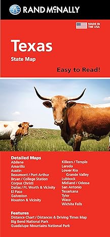
Rand McNally Easy to Read: Texas State Map
by Rand McNally
Published
February 15, 2024
Pages
1 pages
Language
English
Publisher
Rand McNally
Available Formats & Prices
View on AmazonAudio CD
Not found
About This Book
Rand McNally's Easy To Read State Folded Map is a must-have for anyone traveling in and around Texas, offering unbeatable accuracy and reliability at a great price. Our trusted cartography shows all Interstate, U.S., state, and county highways, along with clearly indicated parks, points of interest, airports, county boundaries, and streets. The easy-to-use legend and detailed index make for quick and easy location of destinations.
You'll see why Rand McNally folded maps have been the trusted standard for years. - Regularly updated, full-color maps. - 40% larger map with a bigger type size than the Rand McNally Folded Map.
- Clearly labeled Interstate, U.S., state, and county highways. - Indications of parks, points of interest, airports, county boundaries, and more. - Mileage and driving times map.
- Detailed index. - Convenient folded size. Coverage Area Detailed maps of: Abilene, Amarillo, Austin, Beaumont, Big Bend National Park, Bryan/College Station, Corpus Christi, Dallas/Fort Worth & Vicinity, El Paso, Galveston, Houston & Vicinity, Laredo, Lower Rio Grande Valley, Lubbock, Midland/Odessa, Port Arthur.
Introduction
Explore the Lone Star State with ease using the Rand McNally Easy to Read Texas State Map. Whether you're planning a road trip across vast Texas landscapes or simply navigating the bustling cities, this map provides the essential tools to guide you throughout your journey. Known for its clarity and reliability, Rand McNally’s maps are the ideal companion for both residents and visitors alike.
With comprehensive coverage of roads, highways, and points of interest, this map ensures that you’ll always find your way.
Key Takeaways
Shows major cities highways and points of interest in a detailed format. Durable design perfect for road trips and frequent use. Ideal for travelers seeking a comprehensive guide to Texas.
Detailed Description
The Rand McNally Easy to Read Texas State Map presents an unrivaled level of detail that allows travelers to seamlessly navigate the broad expanse of Texas. Designed for ease of use the map highlights essential transport routes including major highways and interstates ensuring you reach your destination efficiently. Beyond navigation the map offers a wealth of information on scenic byways and must-see attractions making it easier to plan your sightseeing adventures within Texas.
Clearly marked icons indicate places of historical significance shopping districts and natural wonders enriching your travel experience with cultural and recreational insights. Its updated road and city information reflect recent changes in infrastructure providing an accurate and trustworthy resource for planning getaways or business trips. Crafted for convenience its foldable and durable design ensures it withstands regular use making it a reliable companion for both short excursions and lengthy explorations.
Standout Features
What distinguishes this map is its readability designed to assist even the most seasoned of travelers through its intuitive layout and easy-to-read legends The vibrant color scheme and precise detailing make identifying paths and destinations straightforward reducing the hassle of navigation while on the road Enhanced with meticulously labeled maps of major cities and regions Rand McNally integrates user-friendly features with essential travel information ensuring a comprehensive and insightful travel guide.
Book Details
0528028715
978-0528028717
4.2 x 0.5 x 9.3 inches
3.2 ounces
Specifications
Rating
Based on 161 ratings
Create Your Own Books Now
Turn your ideas into reality with our powerful book creation tools. From notebooks to novels, we've got everything you need to publish your masterpiece.
Low-Content Maker
Design journals, planners, and notebooks
FreePuzzle & Activity Maker
Create engaging puzzle and activity books
ProColoring Book Maker
Generate unique coloring pages from images
ProBook Writing Tool
Write your manuscript with our AI assistant
FreeCover Designer
Create professional book covers in minutes
Free+ProA+ Content Designer
Enhance your Amazon sales page visually
Free+ProCustomer Reviews
To help
Bought it to help us decide to our next location to have our final move in Texas.
Maps
I still prefer having a map to plan with rather than just depending on GPS. I’m hoping this map will provide the additional information I want for my upcoming trip.
Helpful
Great quality and great price!
Love
Used it to plan our road trip. Easy to read
Large print
A lot of detail, and large print, much better than free maps given out by any state at a visitor center
Lives up to its name!
This map really is easy to read! Roads are clearly marked!
Helpful map
This is a useful tool.
Easy to read larger print
Rand Mcnally maps are great 😃 if you get the ones marked EASY TO READ they are large print. Exit number easy to read. Rest stops marked. I ordered for several states after a trip. We recently drove from Washington State to Texas for family reunion, the cars Navigation system kept on taking us in weird places. Wish we had the maps for the trip.