Best Sellers Books
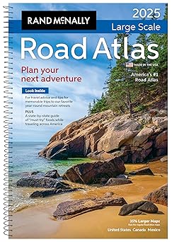
Rand McNally Large Scale Road Atlas 2025
by Rand McNally
Published
March 14, 2024
Pages
286 pages
Language
English
Publisher
RAND MCNALLY & CO.
Available Formats & Prices
View on AmazonAudio CD
Not found
About This Book
Rand McNally 2025 Large Scale Road Atlas The Rand McNally Road Atlas has been the essential, trusted tool for road travelers for more than 100 years. This spiral-bound, updated 2025 Large Scale edition contains maps of every U.S. state, Canada, and an overview of Mexico, that are 35% larger than the standard atlas version.
The atlas also includes detailed inset maps of 375 cities and 28 national parks, plus a comprehensive, unabridged index. Road construction and conditions contact information for every U.S state and Canadian province are conveniently located on map pages. A mileage chart shows distances between 77 North American cities and national parks along with a driving times map.
The tough spiral binding allows the book to lay open easily.
Introduction
Embark on a seamless journey across the US with the Rand McNally Large Scale Road Atlas 2025. Designed for travelers who crave exploration, this atlas provides an unmatched navigation experience. With its comprehensive collection of updated maps and detailed road networks, you can confidently navigate through varied terrains, bustling cities, and scenic routes.
Dive into an unparalleled adventure equipped with accurate data and vibrant visuals that transform driving into a delightful experience.
Key Takeaways
Updated maps and road networks for enhanced navigation across the United States. User-friendly design with detailed information on major cities and attractions. Essential travel guidance and vibrant visuals for an enriched traveling experience.
Detailed Description
Navigate the highways and byways of America with the precision and reliability offered by the Rand McNally Large Scale Road Atlas 2025. This essential travel companion features updated maps that ensure accuracy in every state encompassing vast features that accommodate every traveler’s needs. Immerse yourself in over 350 detailed city inset maps that offer a closer look at urban landscapes simplifying your journey through complex roadways.
Explore the thoughtfully organized content with ease making this atlas a must-have for road enthusiasts. The atlas also includes a plethora of practical tools like mileage charts state fact sheets and a comprehensive index of place names elevating the travel experience to new levels. Discover rich vibrant visuals that portray topographical features and points of interest offering an engaging and comprehensive understanding of each region.
Whether you're planning a family vacation or a road trip this atlas covers all bases.
Standout Features
This 2025 edition stands out for its large-scale maps that offer exceptional detail perfect for those who seek accuracy in their travels Every map is crafted with a focus on clarity and detail The user-friendly layout simplifies navigation and ensures straightforward planning even for the most complex itineraries Its easy reference for city maps and metropolitan areas sets it apart from traditional atlases Designed with travelers in mind it integrates essential travel information such as national park guides and trip-planning tools creating a comprehensive resource that enhances every road adventure.
Book Details
052802759X
978-0528027598
11 x 1 x 15.38 inches
2.65 pounds
Specifications
Rating
Based on 1454 ratings
Create Your Own Books Now
Turn your ideas into reality with our powerful book creation tools. From notebooks to novels, we've got everything you need to publish your masterpiece.
Low-Content Maker
Design journals, planners, and notebooks
FreePuzzle & Activity Maker
Create engaging puzzle and activity books
ProColoring Book Maker
Generate unique coloring pages from images
ProBook Writing Tool
Write your manuscript with our AI assistant
FreeCover Designer
Create professional book covers in minutes
Free+ProA+ Content Designer
Enhance your Amazon sales page visually
Free+ProCustomer Reviews
Put this is your car! GPS outages, no maps for sale on road trip
I recently did a 4-state road trip through AZ, UT, CO & NM. I was with 2 family members and we all have Verizon, plus we had the satellite GPS on the new rental car. Numerous times during our trip, we had zero navigation. We got lost twice because of it. You absolutely can’t rely on GPS. A road atlas is essential. The day after we got back, I bought this. I bought the large size to make it easier to see. We also found out that no gas stations or truck stops carry any maps or atlases anymore. We couldn’t believe it. I will never be without this road atlas in my vehicle again. Buy this right now, for every vehicle in your family. Make sure your family members, especially young people, know how to read a map. Anyone born after Generation X has probably never used a map or compass. Very important to teach them. Drive your kid into the middle of nowhere and make them navigate home using a map. They might not like it, but it might save their life one day. They won’t panic if they find themselves lost & alone, with no GPS or phone service. This is so extremely important for girls and young women. Make sure they can change a tire & use a jack, too. You are never more vulnerable than when stuck on the side of the road or lost in the middle of nowhere, especially if you’re female. It’s an entirely different risk profile than it is for males. Also, all girls/women should have self-defense “tools” at all times. Put a really good kn*fe in the car, at least.
Old School but great information to visualize a trip
This Road Atlas is a big road atlas (Large Scale:11.5 inches wide and 16 tall). That is good and bad. With the large size you get to see more detail and roads in the area whether you are looking at the road map of the state or more local maps but it is almost too big to take on a trip in your car! It is easy to use and follow your trip. It will be in my car for our multi state road trips!
Perfect size
Very happy with this purchase- it arrived on time and had all the features needed. Excellent maps and information- perfect to leave in the car and have at home.
Best Road Atlas on the Market
Great atlas! Large easy to read pages give you a perfect way to plan any trip in the US. Easy to navigate the atlas giving you situational awareness of your trips progress. It is also a great learning tool for the kids and they enjoy following the map and learning the states. This atlas is much better than say Google Maps.
Great for traveling
It is big and a little heavy. But other than that it was easy to read and easy to find our much needed stops. We also found some other interesting stops that we did not know existed. It will be coming with us at every drive thru the Mid-West.
Awesome Atlas
A great UPDATED atlas to use when traveling the great lands of the USA. The spiral bound keeps it in place and is so practical to keep multiple maps together. It's easy to navigate, with detailed city maps that are easy to read. You can easily follow the map from one state to the next. It also includes Canada and other places. It gives you snippets about the popular food to try and sight suggestions to visit in that location. A great buy if you're traveling the States.
Maps are very Useful.
These are the back-up maps for when I don't have service for Google Maps. Large and easy to read. Kept in the vehicle.
Great maps!
The large size makes it easy to read at a distance and the spiral binding means you can have it protected in a door or seat pocket and open it to the state you need and leave it open on a seat. Its large enough to hunt down and mark small roads and landmarks during your travels. And of course its up to date with the latest road closures or new ones as its made this year. I like to take my jeep down little known trails and roads in AZ to visit ruins and desert features. This map makes it easy to ponpoint where you are visiting for future reference. It also has detailed road maps of the major cities in each state. Very easy to find the state and or city|town you want to visit or to plot your path across states you visit. Years ago, State Farm used to give me one of these every year for having insurance. They dont seem to do that any more, but this book of maps is so useful, I'll likely buy a new one every couple of years. Its hard to get lost in the USA when you have these. Much better than relying on GPS devices that often are only updated every few years and you dont need electricity to use these (grin). Well worth the pirchase cost!